[:fr][vc_row][vc_column][vc_column_text]
Immergis a participé au workshop à Malaga
Les 30 et 31 Mars dernier, Immergis a participé au workshop organisé par IRF à Malaga (Espagne) sur le thème « Road Network Safety Management in Faste-Motorizing Economies », et Immergis a réalisé une présentation sur le sujet « Using GIS to prioritize intervention to the network ».[/vc_column_text][/vc_column][/vc_row][vc_row][vc_column][vc_empty_space][vc_gallery images= »2167,2168″ img_size= »medium »][vc_column_text]
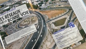
Nouveau projet routier avec le Département de Haute-Loire
Le Département de Haute-Loire a choisi Immergis pour son projet de géolocalisation d’objets routiers sur tout le Département, soit 3 400 Km de routes départementales. Ce projet a pour objectif d’améliorer la qualité des données produites dans le SIR (Système d’Information Routier) du Département.
[/vc_column_text][/vc_column][/vc_row][vc_row][vc_column][vc_single_image image= »2174″ img_size= »medium » alignment= »center »][/vc_column][/vc_row][vc_row][vc_column][/vc_column][/vc_row][:en][vc_row][vc_column][vc_column_text]
Immergis participated to the IRF workshop in Malaga
On the last 30th and 31st of March, Immergis was present at the IRF Workshop in Malaga (Spain). This event focused on Road Network Safety Management in Faste-Motorizing Economies, and Immergis made a presentation about « Using GIS to prioritize intervention to the network« .[/vc_column_text][/vc_column][/vc_row][vc_row][vc_column][vc_empty_space][vc_gallery images= »2167,2168″ img_size= »medium »][/vc_column][/vc_row][vc_row][vc_column][vc_column_text]
New road project with the French department Haute-Loire!
The french department of Haute-Loire has choosen Immergis for its roads objects geo-positioning on the entire departmental territory (3400km roads). This project has the objective to improve the data quality in RIS (Road Information System)[/vc_column_text][/vc_column][/vc_row][vc_row][vc_column][vc_single_image image= »2174″ img_size= »medium » alignment= »center »][/vc_column][/vc_row][vc_row][vc_column][/vc_column][/vc_row][:]

![You are currently viewing [:fr]Workshop à Malaga et nouveau projet routier[:en]Workshop in Malaga and new road project[:]](https://immergis.fr/wp-content/uploads/2017/04/cwvDm9asA_Lw9YsGTQNy8vW7Zxw.jpg)

