Les grandes villes du continent africain font face aux effets du changement climatique et à des catastrophes naturelles qui s’intensifient. La population, de plus en plus nombreuse, devient davantage vulnérable face à ces catastrophes et se retrouve confrontée à des inondations, à la perte de leur habitat entrainant des mouvements migratoires et des risques sanitaires élevés.
Face à ce constat, la Banque Mondiale a confié à différents partenaires, dont Immergis et sa succursale Immergis Cameroun, la mise en œuvre de l’initiative Villes Ouvertes en Afrique – Open Cities Africa. Cette initiative s’inscrit dans une prise de conscience et une démarche globale de la part des différentes institutions internationales engagées pour le développement et la préservation de l’habitat naturel et urbain, donnant à leur résilience une nouvelle dimension (Global Facility for Disaster Reduction and Recovery (GFDRR) et Open Data for Resilience Initiative (OpenDRI). Immergis est fière de participer à cette initiative pour la ville de Saint-Louis au Sénégal ainsi que pour la ville de Pointe-Noire, capitale économique du Congo.
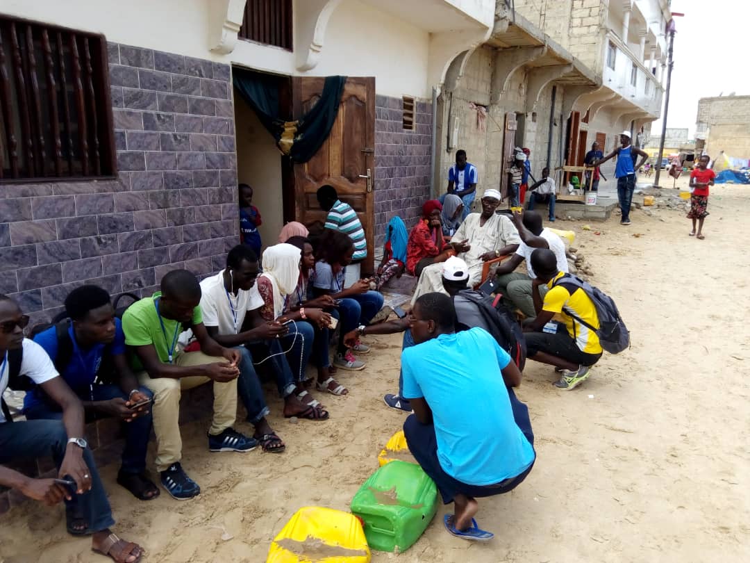
Par notre expertise dans le domaine de l’information géographique, et par notre association avec le cabinet sénégalais d’études BEST, expert dans les problématiques environnementales, nous menons une campagne de sensibilisation des communautés et des institutionnels Saint-Louisiens et Sénégalais autour de l’information géographique et de son rôle essentiel dans l’appui à la gestion de la croissance urbaine et du risque de catastrophes naturelles.
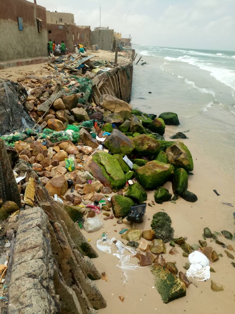
Située en bord de mer, la ville de Saint-Louis est naturellement exposée aux risques d’érosion côtière et d’inondation. Au niveau des quartiers historiques de la Langue de Barbarie et de l’île de Saint-Louis, les habitats sont progressivement engloutis par le recul du trait de côte depuis plusieurs décennies. Les équipements socio-économiques sont menacés par l’érosion côtière et les nombreuses inondations, constituant ainsi un risque socio-sanitaire élevé.
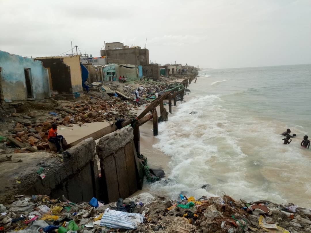
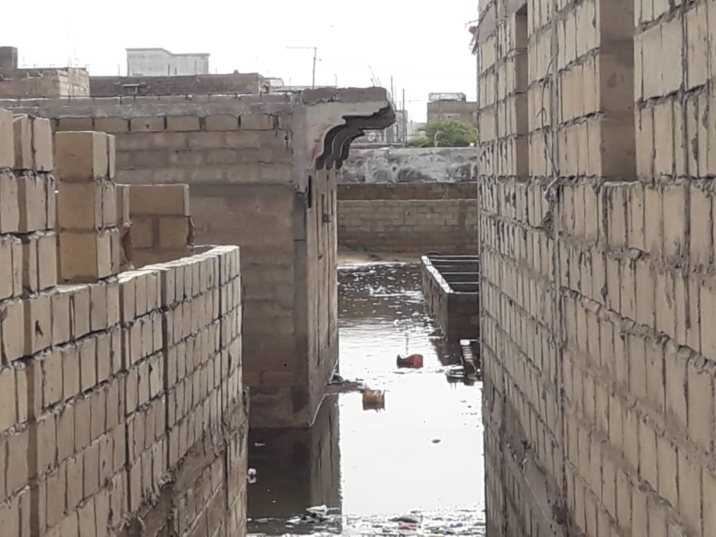
L’absence de données géographiques détaillées et à jour limite les perspectives de résilience face aux risques du changement climatique. Ainsi, un quartier entier de Saint-Louis fut bâti sur un site non aedificandi d’anciennes vasières remblayées avec des ordures ménagères.
Les eaux de pluie stagnantes et les remontées de la nappe phréatique sub-affleurante provoquent des inondations qui impactent négativement le cadre de vie et fragilisent considérablement la santé des populations (prolifération des moustiques vecteurs de paludisme, maladies diarrhéiques et de la peau, risques de choléra,…).
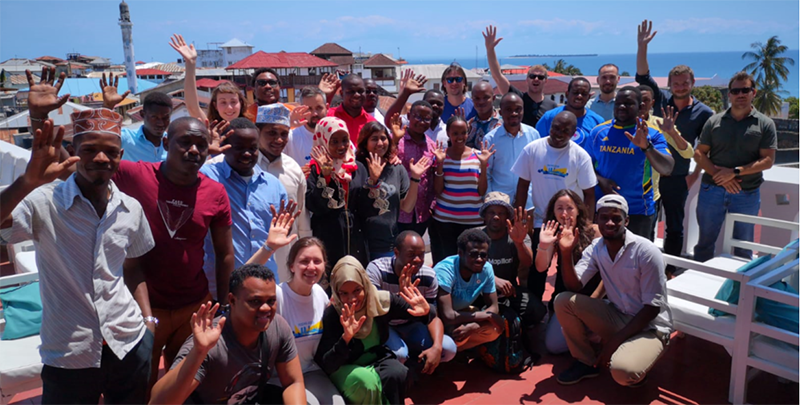
Conformément au souhait de la Banque Mondiale, notre équipe, constitué d’experts du groupement Immergis-BEST, met en oeuvre une approche collaborative pour recueillir et disposer de données géographiques détaillées et à jour en utilisant la plateforme mondiale OpenStreetMap (OSM).
L’Université Gaston Berger s’est engagée à nos côtés pour intégrer la cartographie participative via l’outil OSM dans le cursus des étudiants en Géographie et de ce fait permettre de sensibiliser les communautés locales aux perspectives de résiliences offertes par l’information géographique.
Des partenariats ont ainsi été initiés avec plusieurs des acteurs clés afin de permettre le renforcement des capacités et assurer la pérennité du projet sur le long terme.
La cartographie participative de cette première phase a permis de mettre à jour et de compléter les données géographiques liées à la gestion des risques face aux catastrophes naturelles sur les zones prioritaires. Nous développons actuellement un outil pilote ayant pour objectif de faciliter le partage et l’amélioration de l’utilisation de ces données géographiques.
Nous sommes ravis de contribuer dans ce projet de la Banque Mondiale : Villes Ouvertes en Afrique ainsi que d’accompagner les différents acteurs dans leur prise de décision et leur permettre ainsi une meilleure gestion des risques #opencities @WBG_Cities @UnderstandRisk @GFDRR.
Pour en savoir plus sur cette initiative, visitez www.opencitiesproject.org
Pour en savoir plus sur nos services rendez-vous sur https://immergis.fr/ et suivez-nous sur Twitter https://twitter.com/immergis .
![Lire la suite à propos de l’article [:fr]Construction Cayola parle d’Immergis ![:]](https://immergis.fr/wp-content/uploads/2017/04/titre_article-300x211.png)
![Lire la suite à propos de l’article [:fr]Immergis sponsor de l’IRF Africa Regional Congress en Namibie ![:en]Immergis is sponsoring the IRF Africa Regional Congress in Namibia![:]](https://immergis.fr/wp-content/uploads/2017/07/Capture-300x168.png)