IMMERGIS has developped a specific service offering for road infrastructure managers. This service includes the conception of a road GIS-Database, realised with a mobile mapping solution for data collection, and softwares solutions for asset’s milestones attachment.
GIS-Database creation
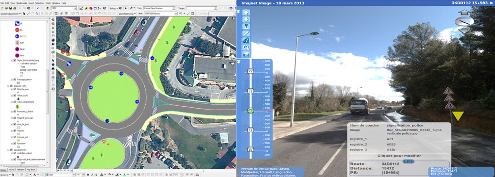
Collected GIS-data are:
- Accurate (geographical precision: sub-metric, linear referencing system)
- Qualitative (network’s asset condition: pavement, signs, equipments, etc.)
- Quantitative (quantity by type of asset)
- Exhaustive (complete inventories)
- Visual (image database)
Thematics collected in X/Y/Z, and PR+Abs.
- Roads network linear: organised, accurate, ranked
- Milestones: kilometer marquers, horizontal marking, etc.
- Shoulders: ditch, sidewalk, embankment, etc.
- Signs: directions, vertical, police, etc.
- Road structures: type, condition, etc.
- Security equipment: type (safety barrier, concrete barrier, etc.), condition, etc.
- Aligning trees: essence, condition, etc.
- Public lighting: pole type, etc.
- Advertising signs: surface, etc.
- School transport: bus stops attributs, etc.
- Light transport ways: cycleways, footh paths, etc.
- Other thematics on demand
Deliverables
- GIS layers (ArcGIS®, Mapinfo®)
- Integration in GIS, RIS (Road Information System) or state softwares
- Platform and/or diffusion tool of the images database.
Benefits
- Competencies transfer: we can support technical teams of road infrastructures managers, to ensure the asset inventory management and update
- Cost optimisation: by making a complete network inventory and condition assessment to anticipate and prioritise road works.